
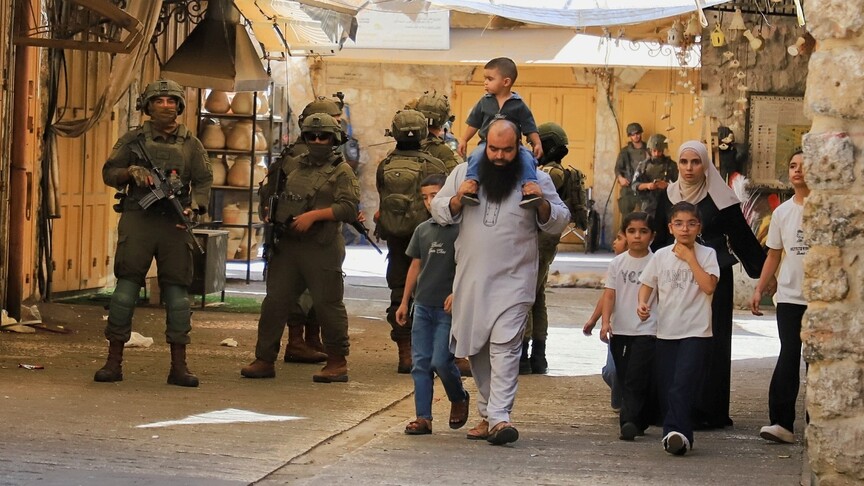
An extensive web of Israeli military checkpoints, gates, and barriers weaves through the occupied West Bank, significantly limiting Palestinian movement and fragmenting communities from each other and their farmland. This system has reached alarming figures, with reports from the Palestinian Colonization and Wall Resistance Commission and the UN Office for the Coordination of Humanitarian Affairs (OCHA) indicating that there are currently 942 checkpoints and other forms of barriers in place.
### Scope of the Barrier Network
The checkpoint system consists of 824 permanent checkpoints and closure points, along with 118 linear obstacles, such as earth mounds, trenches, and roadblocks—altogether extending over 107.7 kilometers (or approximately 70 miles). The widespread nature of these restrictions means that residents face considerable challenges when moving between cities, towns, and villages, disrupting their daily life and agricultural activities.
### Hebron: The Most Impacted Area
Among the various governorates in the West Bank, Hebron stands out as the most affected by this network, holding the highest number of checkpoints and closure points at 221. Following Hebron, Ramallah and Al-Bireh have 160, while Nablus has 120, Bethlehem is at 78, Jerusalem 62, Qalqilya 41, and Salfit 40. Jericho and the Jordan Valley face 27 barriers, Jenin and Tulkarem each have 26, and Tubas contains 23. The recent addition of 13 fixed checkpoints in the last couple of months highlights the evolving nature of this oppressive system, particularly in the Jenin governorate, where checkpoints have proliferated from 16 to 26.
### Mechanisms of Control
The barrier network is extensive, incorporating not just checkpoints but also iron gates that block access to key routes, towns, and agricultural areas. Israeli forces use these barriers to exercise considerable control over Palestinian movement, making it difficult for individuals to access workplaces, farms, and essential services. The closure of a single gate can force residents into longer detours or isolate entire communities for hours or even days. Escalating restrictions have created a fragmented environment resembling “cantons,” with residents’ mobility dependent on the unpredictable opening and closing of barriers.
### The Continuous Expansion of Barriers
Data indicates that this system has not only persisted but expanded significantly over the past two decades. In 2003, there were approximately 757 barriers recorded; that number grew to 630 by 2008 and reached 705 in 2018. Most recently, OCHA reported that 942 barriers were operational, highlighting a shift from temporary earth mounds to more permanent checkpoints and gates. These developments enhance the capacity of Israeli forces to control Palestinian movement, directly impacting daily life.
### The Consequences of Restrictions
The continuous growth of this barrier network has profound implications for Palestinians, affecting their access to agricultural land and economic opportunities. Students, patients, and workers face hurdles that hinder their ability to reach schools, hospitals, and job sites, varying based on the location and nature of closures. The expanding military restrictions further complicate travel between geographically close communities, exacerbating the isolation many residents experience.
### Conclusion
The current situation reveals that the barriers do not function in isolation but as part of a comprehensive and interconnected system. This pervasive network has transformed simple journeys between towns into elongated processes through multiple checkpoints and control points, solidifying a reality where barriers dictate the rhythms of Palestinian life. As access becomes increasingly restricted, the necessity for advocacy and awareness around these issues has never been more urgent.